

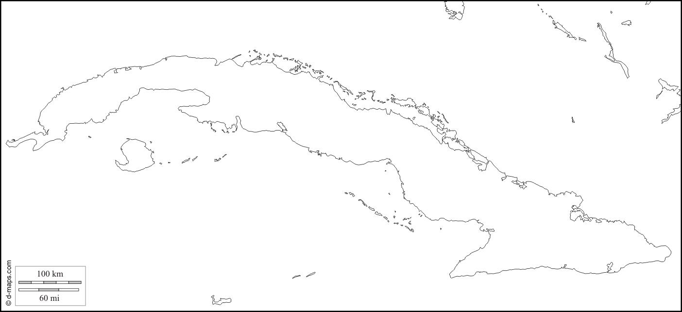
You can find on this page the blank map of Cuba to print and to download in PDF. The contours map of Cuba presents the international boundary of Cuba in Caribbean - Americas. You can use the vector map of Cuba for personal or educational use.
The blank map of Cuba shows the country Cuba empty. This blank map of Cuba will allow you to use the map for personal activities or educational with children for example (drawing). The empty map of Cuba is downloadable in PDF, printable and free.
The country of Cuba total area is almost identical to that of Ohio. Cuba extends about 780 miles (1,250 km.) in a somewhat curved east-west direction as its shown in the Blank map of Cuba. This is about the same distance as between New York City and Chicago. The narrow width varies from 25 to 120 miles (40 to 195 kilometers). Many people use a Blank map of Cuba to define its political boundaries and the nearby islands.
The Blank Map of Cuba represents Cuba, which is considered the largest island country situated in the Caribbean Islands or the West Indies. A map of Cuba for practice worksheet enables all the students who are interested to learn the geography of Cuba. The practice worksheet is readily available and designed with questions related to the subject. Such a practice worksheet will facilitate the users in their regular practice.
All the above details of Cuba can be marked on a blank map of Cuba, including mountains and bordering countries of the Island. It can be colored with different color configurations, which can be presented as part of a school assignment. As per official estimates of the population recorded in 2007, this island nation recorded a population count of 11.2 million. Its capital city is Havana, and the official language spoken is Spanish. The Blank map of Cuba depicts provincial boundaries, the location of the national capital, major cities, main roads, railroads, and major airports.
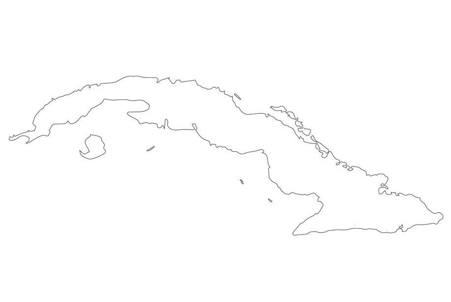
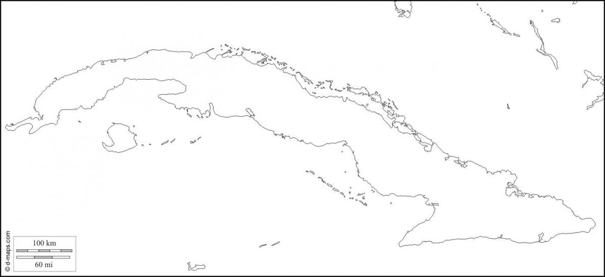
The Cuba map outline shows all the contours and international boundary of Cuba. This outline map of Cuba will allow you to easily learn about neighboring countries of Cuba in Caribbean - Americas. The Cuba contours map is downloadable in PDF, printable and free.
Cuba lays astride principal maritime approaches to the Atlantic Ocean, the Gulf of Mexico, and the Caribbean Sea as you can see in Cuba map outlines. These approaches are the Straits of Florida to the north, the Windward Passage to the east, and the Yucatan Channel to the west. These narrow waterways (straits) have played key roles in the history of Cuba. For example, when Cuba was a Spanish colony, Spanish fleets carrying gold and other precious cargo were vulnerable to attack as they converged on the straits.
The Cuba map outlines can be downloaded, printed, and used for educational purposes. From the Cuba outline map, it is possible for the user to learn and understand how to draw an accurate map of the country from scratch. The Cuba map outline template offers complete guidance to beginners so that they do not make any errors in the process of drawing the geography of the country.
The land of Cuba is relatively soft flowing, gradually in the direction of hills, which consists of limestone hills as its shown in Cuba map outlines. However, the coastal line of the country is mostly mountainous. Cuba is surrounded by Florida and The Bahamas in the south. Cuba has the Caribbean Sea to its north with Jamaica and the Cayman Islands. The country shares maritime borders with the US, Mexico, Jamaica, Honduras, Haiti, Bahamas. When compared to its land area, it is about the size of Bulgaria or slightly smaller than that of the US state of Pennsylvania.
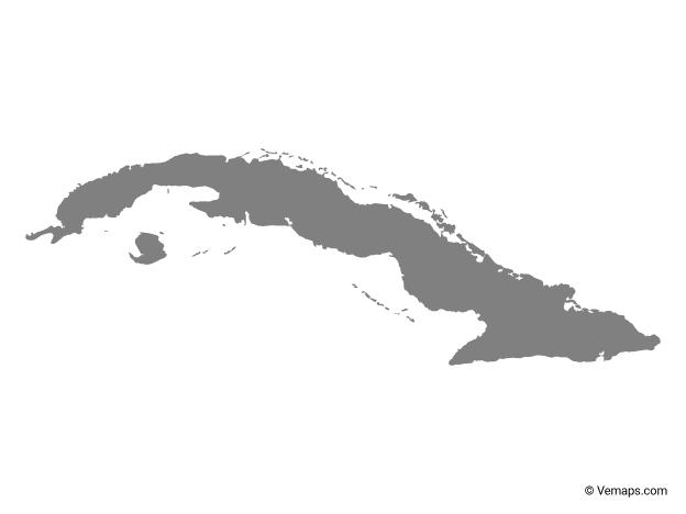
The vector map of Cuba shows entire surface of Cuba empty. This vector map of Cuba will allow you to make changes or add details to the map of Cuba in Caribbean - Americas, for personal or educational purposes. The vectorial map of Cuba is downloadable in PDF, printable and free.
Ninety miles off the tip of Florida lies a Caribbean isle shaped like a crocodile as you can see in Cuba map vector. That is fitting, because the island of Cuba is home to rare “leaping” crocodiles — and a host of other unusual animals, including some of the world smallest hummingbirds, frogs, and lizards. There are caves full of bats and their wily predators, snakes. The country is also known as El Cocodrilo or El Caiman which translates to “The Crocodile” and “The Alligator” respectively. The reason behind these unusual nicknames is due to the appearance of the island when viewed from above. From an aerial view, Cuba appears like a large alligator.
The Republic of Cuba is comprised of Cuba, the main island; four archipelagos — the Sabana-Camagüey, the Colorados, the Jardines de la Reina, and the Canarreos; and smaller islands. The republic covers more than 110,000 square kilometers, about the size of Virginia as its shown in Cuba map vector. Cuba includes a patchwork of habitats, from fields and swamps to mountains and forests. Cuba is composed mostly of limestone, a soft, porous rock that easily erodes. As a result, the island is honeycombed with caves and has the highest density of caves of any place on earth.
There are steep mountain ranges in Cuba: the Sierra de los Órganos, the Sierra de Trinidad, and the Sierra Maestras. The Sierra de los Órganos are made up of “mogotes,” a set of oddly dome-shaped mountains. Pico Turquino, part of the Sierra Maestras, is Cuba tallest peak, rising up south of the Guantanamo Valley to about 6,500 feet (see Cuba map vector).